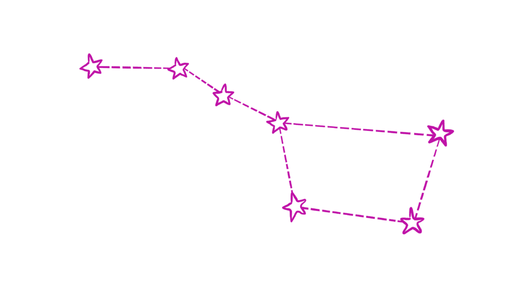
Can stars in the night sky tell us a story?
Stars, their positions, and their science have been a part of traditional navigation and oral histories for generations.

Memorizing the Stars
Learn how traditional Polynesian voyagers navigate using the Hawaiian Star Compass, a tool to memorize the rising and setting points of stars.
Following Polaris to Freedom
Learn why enslaved individuals followed a star named Polaris during their dangerous journey north to freedom.
Mapping Oral Histories
Learn how some Native American tribes recorded oral histories and important events, including meteor storms!
Click on the map icons below to uncover three stories of humans using stars to navigate and find their way.
Still Curious?
Excited to learn more about the stories outlined on the map? Browse the links below to explore more!
Explore Polynesian Voyages
Curious where the Polynesian Voyaging Society is sailing right now? Click here to find out.
Discover the North Star
Interested in finding Polaris in the night sky? Our friends at NASA walk you through finding the North Star and more.
View Lone Dog’s Winter Count
See details of Lone Dog’s Winter Count and the historical events each drawing represents. The Leonid Meteor Storm is depicted as red falling stars around a black crescent moon.
View the Hawaiian Star Compass
Explore the Hawaiian Star Compass. The compass is a way of mentally viewing and memorizing the stars instead of a physical tool.
Follow the Underground Railroad
Learn more about the network of safe houses and resources available to slaves escaping via the Underground Railroad
Chase the Leonids
Leonid Meteor Showers can be seen every year in mid-November. Learn more about how to view them in your area!
What did you discover?
Let’s Think…
What is one thing you learned?
Have you ever used the stars to find your location?
Does your family use the stars to tell stories?
How can star stories teach us science?
What’s the Science?
Stars make great maps!
Just like the sun, stars rise in the east and set in the west (remember, the sun is also a star!). If you set up a time-laps video over an entire night, the stars visible to your camera would appear to sweep across the night sky in a semi-circular pattern. For Polynesians navigating the Pacific Ocean, memorizing where and when certain stars rise and fall is key to navigating in the right direction.
For others, it is more helpful to navigate using a star that stays still in the night sky. For this, travelers in the Northern Hemisphere rely on Polaris, the North Star.
Earth rotates around an axis that extends from the north pole to the south pole, making a single rotation every 24 hours. Polaris sits right above Earth’s north pole. This means that, as Earth rotates throughout the night, the position of Polaris shifts only a tiny amount. Navigators can rely on Polaris to always point north and for all other stars to rotate around it.
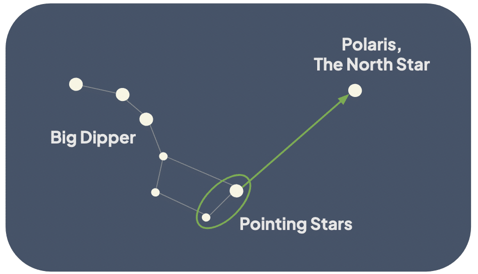
In the Southern Hemisphere, navigators look toward Sigma Octantis, the southern pole star.
More Ideas
Continue your adventure with these resources!
Visit the Planetarium
Explore OMSI’s Kendall Planetarium programming – there is something for everyone!
Create your own Star Map
Write your own map using the stars above you. Can you give someone directions using your star map?
Explore All
Check out all of OMSI’s Science at Home videos and experiments.
Thanks to Our Sponsors
This project is made possible by a grant from the Marie Lamfrom Charitable Foundation.

Top Image Credit: NASA/Donald R. Pettit